Discover my account of my three-day trek around Gran Sasso, this well-known Italian mountain that is the highest point of the Apennines, in Abruzzo. Very wild landscapes and vast grassy and windy expanses are the key! One of the most memorable moments of the trek, in my opinion, is the view of Campo Imperatore, this immense alpine pasture suspended at an altitude of 1700m: a landscape so unique that it is never forgotten.
We followed our own route, sometimes passing on poorly marked trails. The gpx file can be quite imprecise because it was drawn manually (not recorded in the field). Both the start and end of the trek are accessible by bus from L'Aquila. We did the trek in early June, and it was actually a bit early for the season: there were still many snowfields and we did not go to the summit of Gran Sasso because of the snow. That said, the snow-capped peaks made for spectacular photographs.
As usual, we opted for a tent to complete this Gran Sasso trek with maximum flexibility. Bivouacking is tolerated in most mountain areas of Italy, as long as you're far enough away from civilization. And sleeping in the flowery mountain pastures of Abruzzo is enchanting!
Gran Sasso Trek, Day 1: From Arischia to the highlands
+ 1750 m / – 450 m 19km
We leave the village of Arischia fresh and laden, after an early departure on the Flixbus from Rome. As we pass the houses, we chat a little with the locals. It's clear that hiking isn't exactly part of local customs: "Where are you going with those big bags?" "Towards the Gran Sasso!" "Towards the Gran Sasso? But take the road!"
We quickly climb behind the village, along a large path. The view becomes more open, we can make out neighboring peaks, and in the distance, the Majella and the Sibillini Mountains. It's June, but a cool wind is blowing; it's not so hot at altitude. A spring along a torrent (called Nocicchia on the map) provides us with our first supply of water.
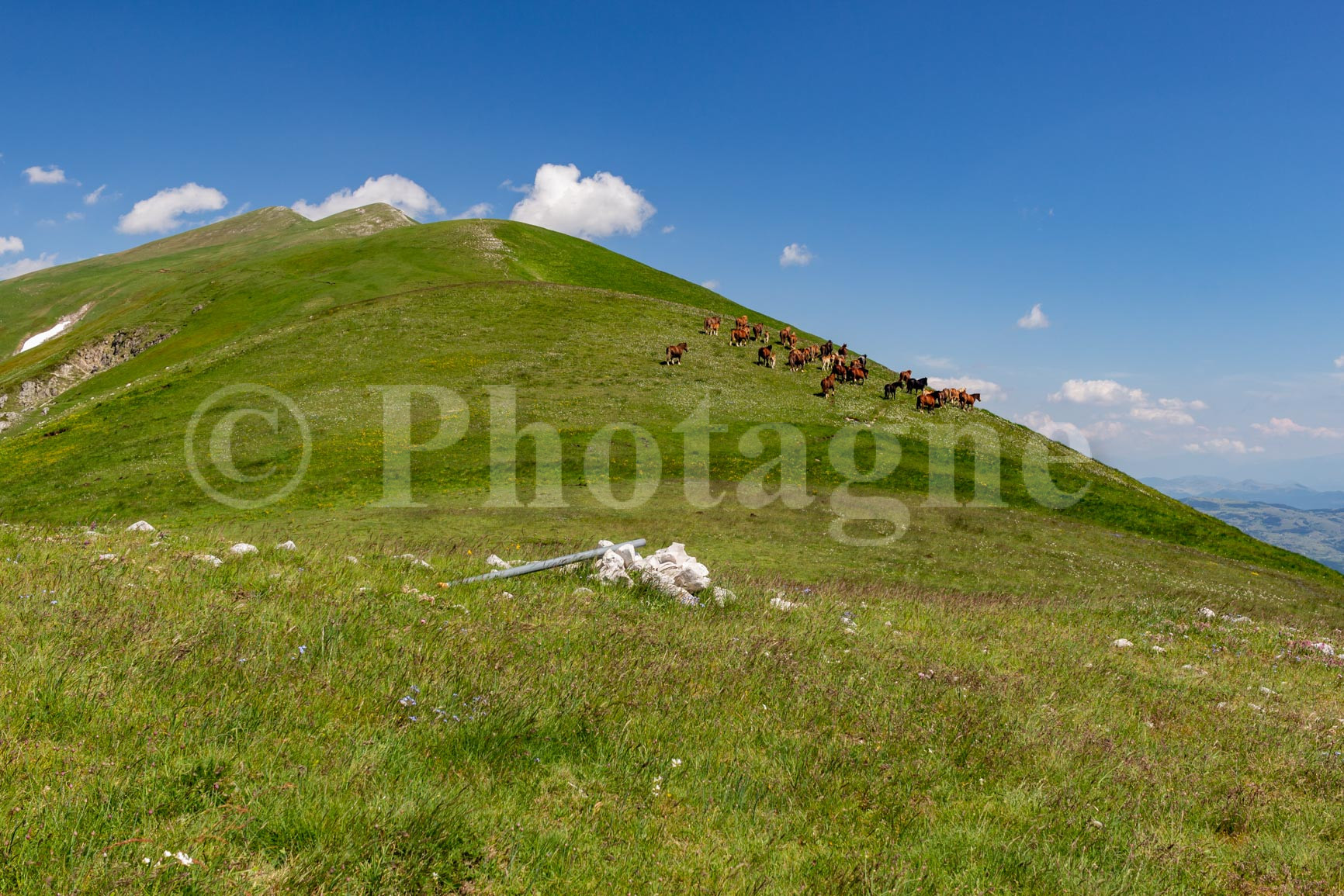
We arrive at a first grassy plateau, which we cross. The path isn't well marked, and we generally prefer to follow it across the fields; the direction isn't complicated to follow. Once we cross the road, we have another steep climb. At the pass, a herd of free-roaming horses awaits us.
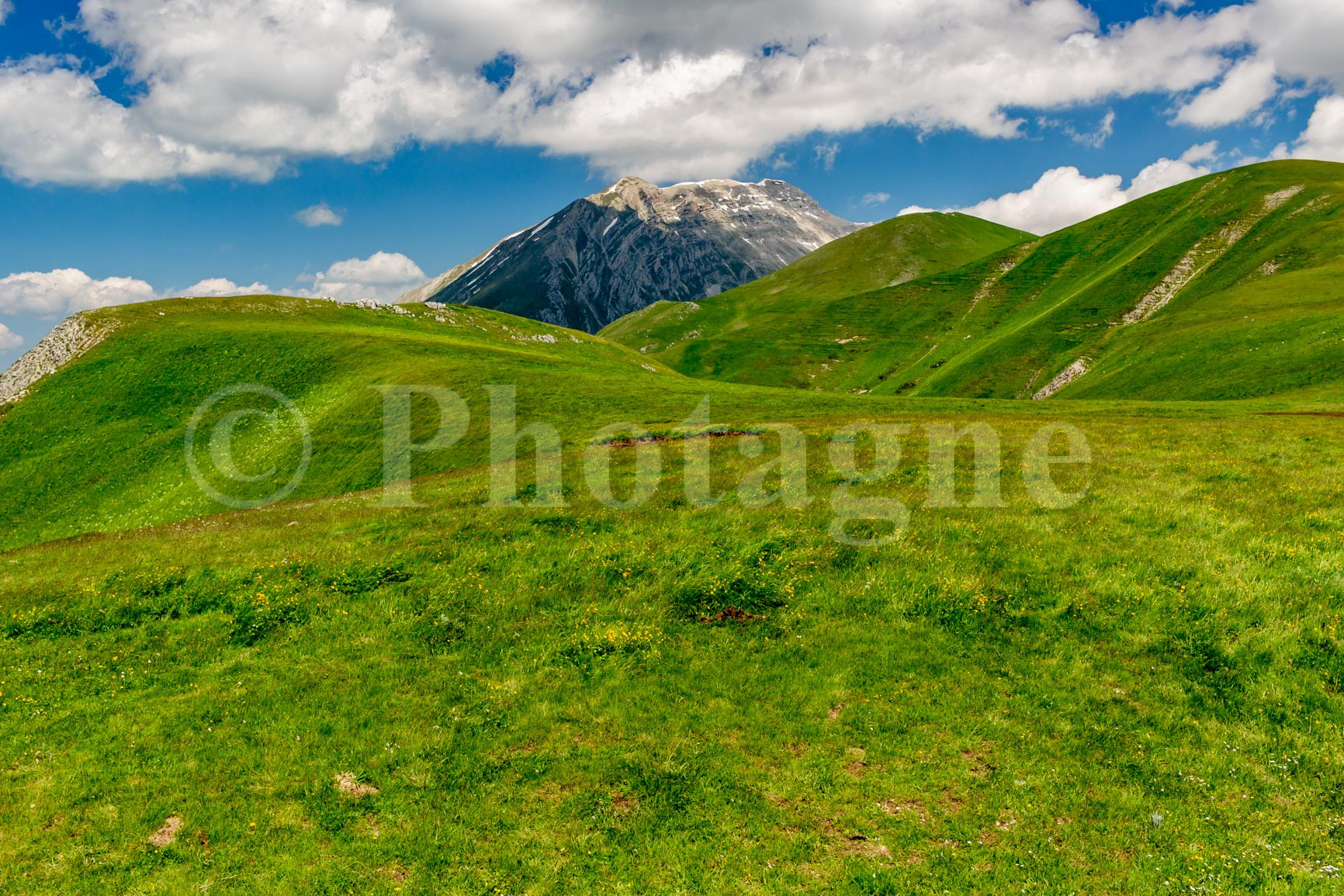
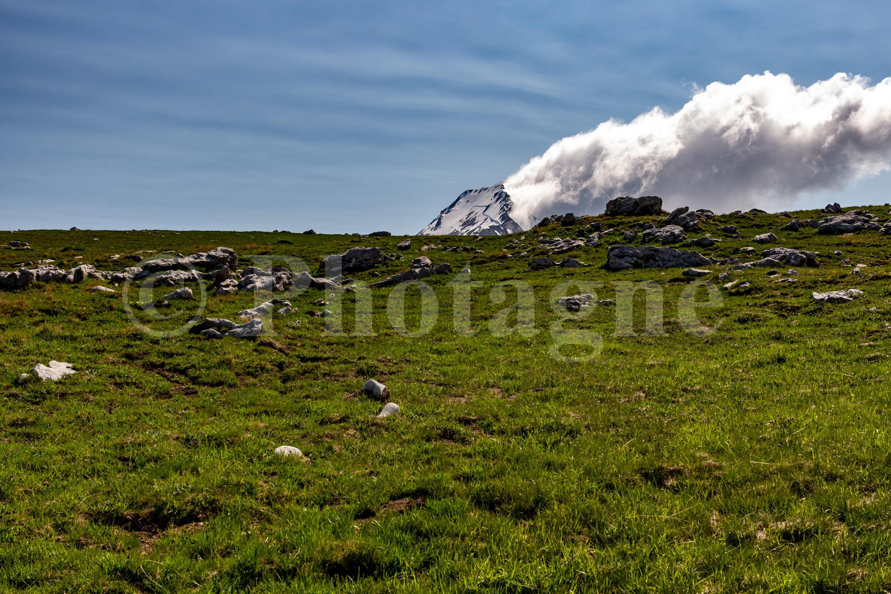
The landscape is still grassy, but we feel like we're starting to reach a high mountain area. The neighboring peaks are impressive, and we can see the first snowfall. We continue on a very scenic path along the ridge.
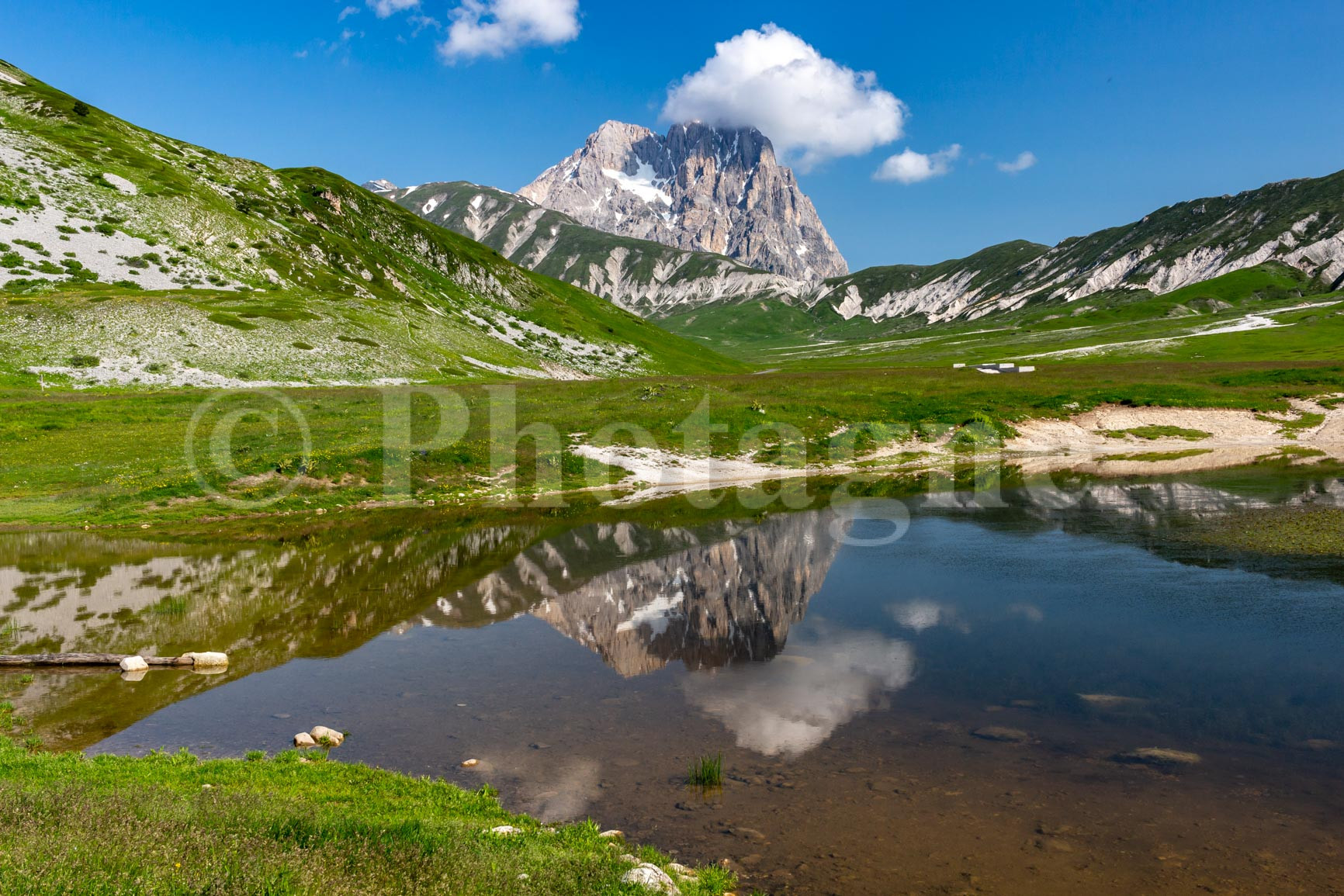
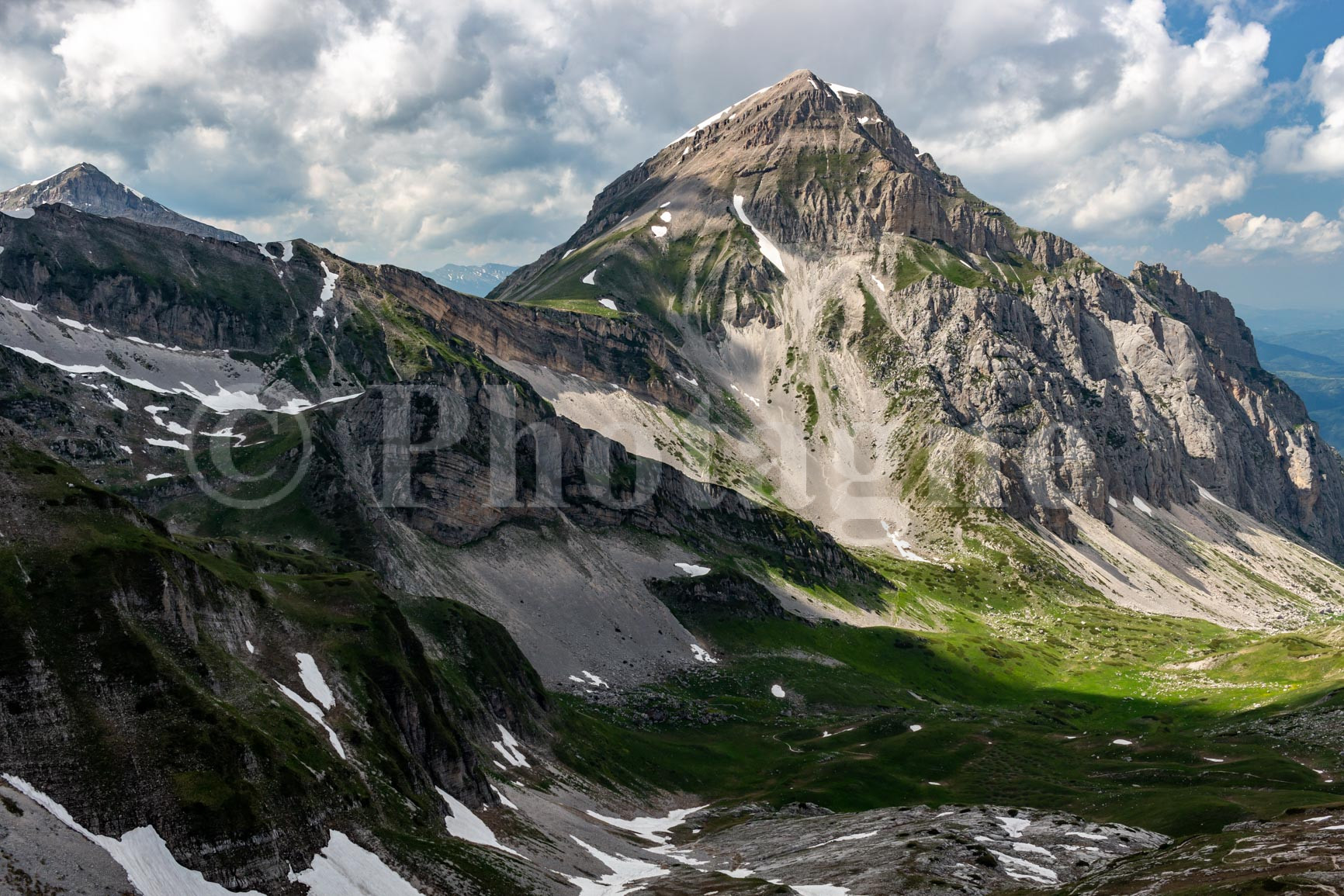
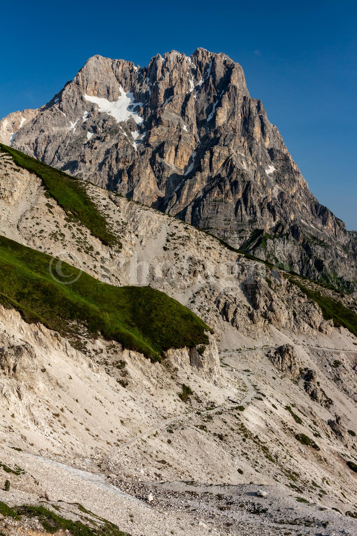
We finally arrive at the Pizzo di Camarda, the highest point of the day. We see the Gran Sasso all white in front of us; it's magnificent. I wasn't expecting such an alpine landscape in the Apennines!
We finally descend from the Sella delle Malecoste via a small, steep scree path. At the bottom, there's an ideal spot to pitch a tent: a few patches of grass between stones and snowfields. A high-altitude feeling guaranteed!
Day 2: Pizzo d'Intermesoli
+ 1600 m / – 1700 m 16km
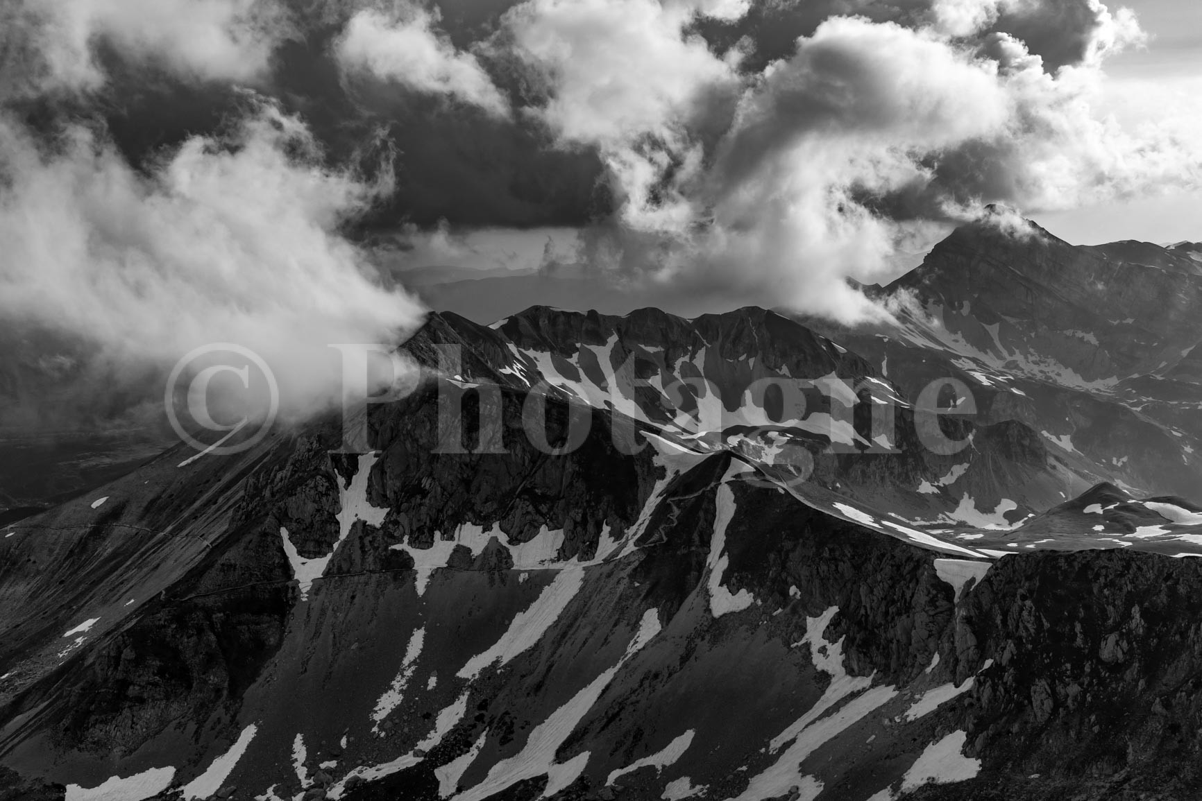
The wind blew in the morning, preventing us from sleeping because our tent was tossing around. So we set off early and crossed the Sella Falasca. A chamois watched us from afar on the way down. We made a short detour on the way back to the Venacquaro spring, as we were dry. To our right, the northern slope of the mountain was still well covered in snow.
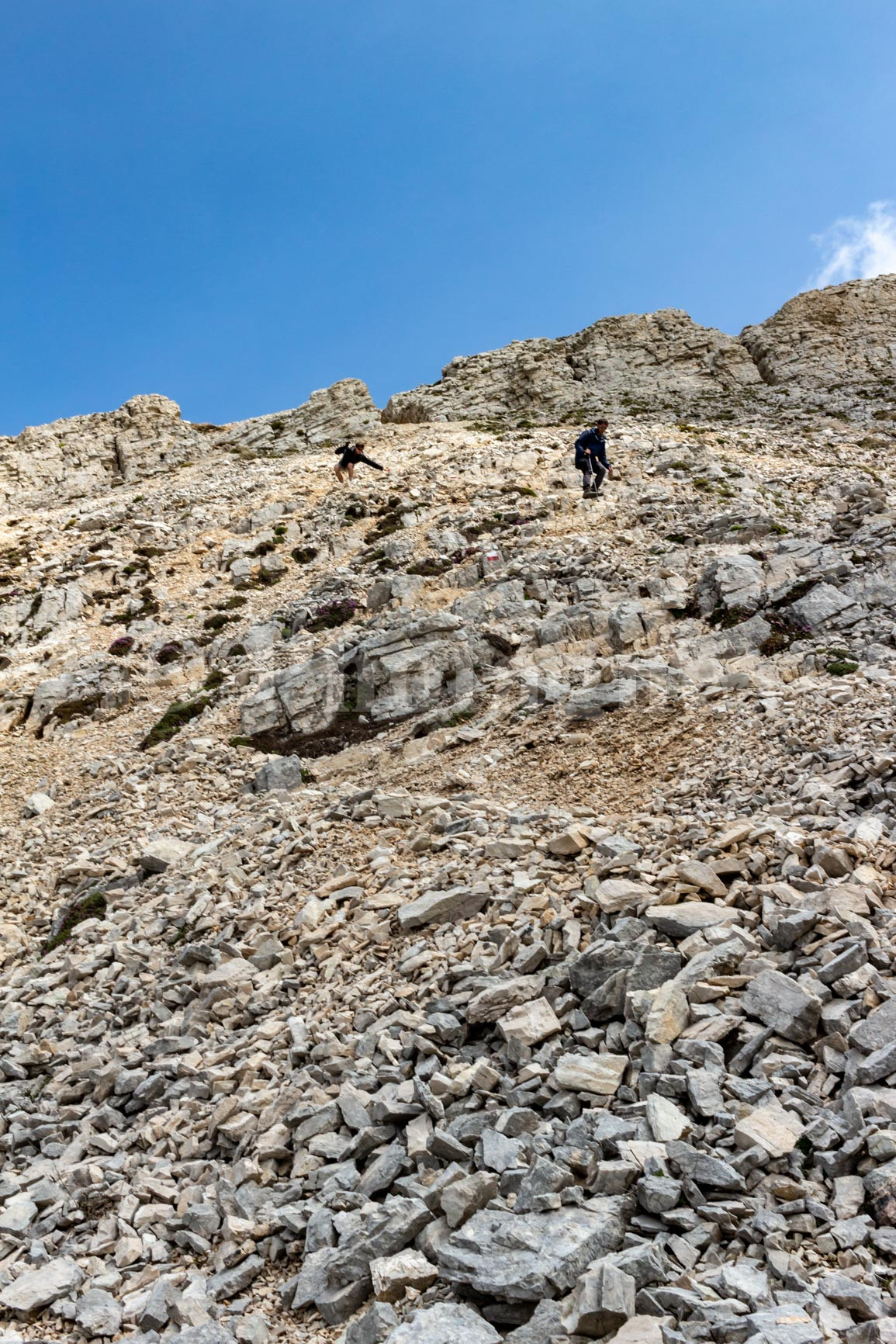
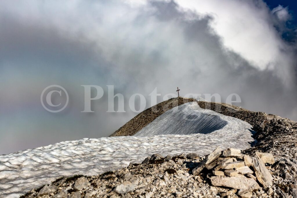
We then climb back up to reach the Sella Dei Grilli. From there, as it is now clear that we will not be able to reach the summit of Gran Sasso due to the snow, we decide to fall back on another nearby peak: the Intermezzoli peak. The path is poorly marked and a little steep in places, especially in the scree. But it does not present any great difficulty.
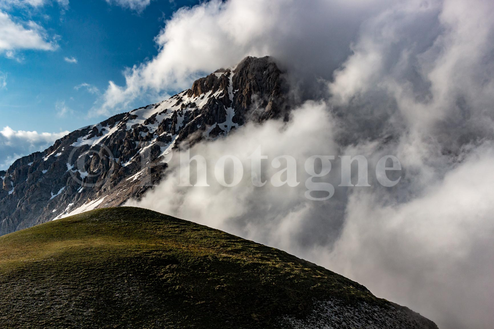
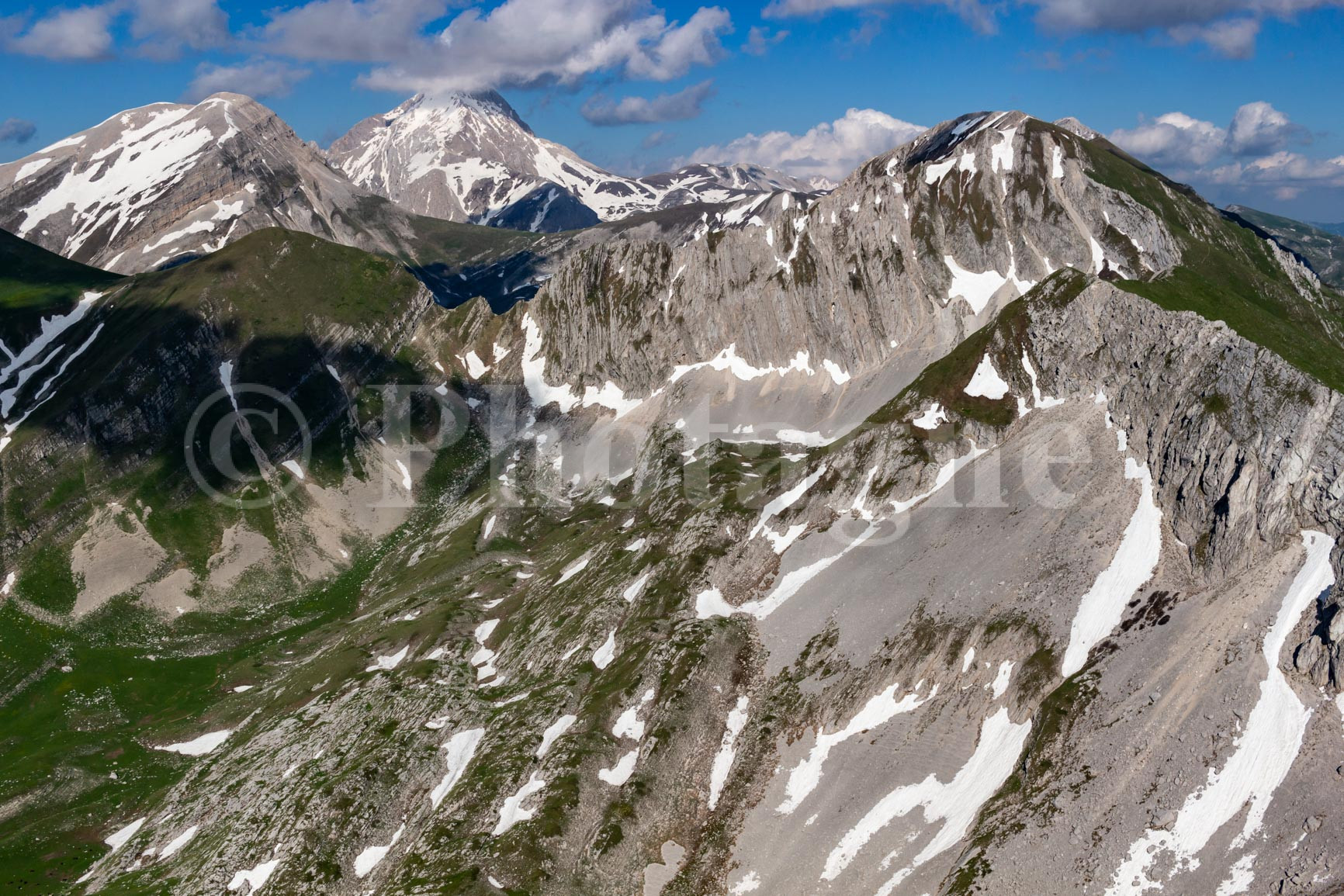
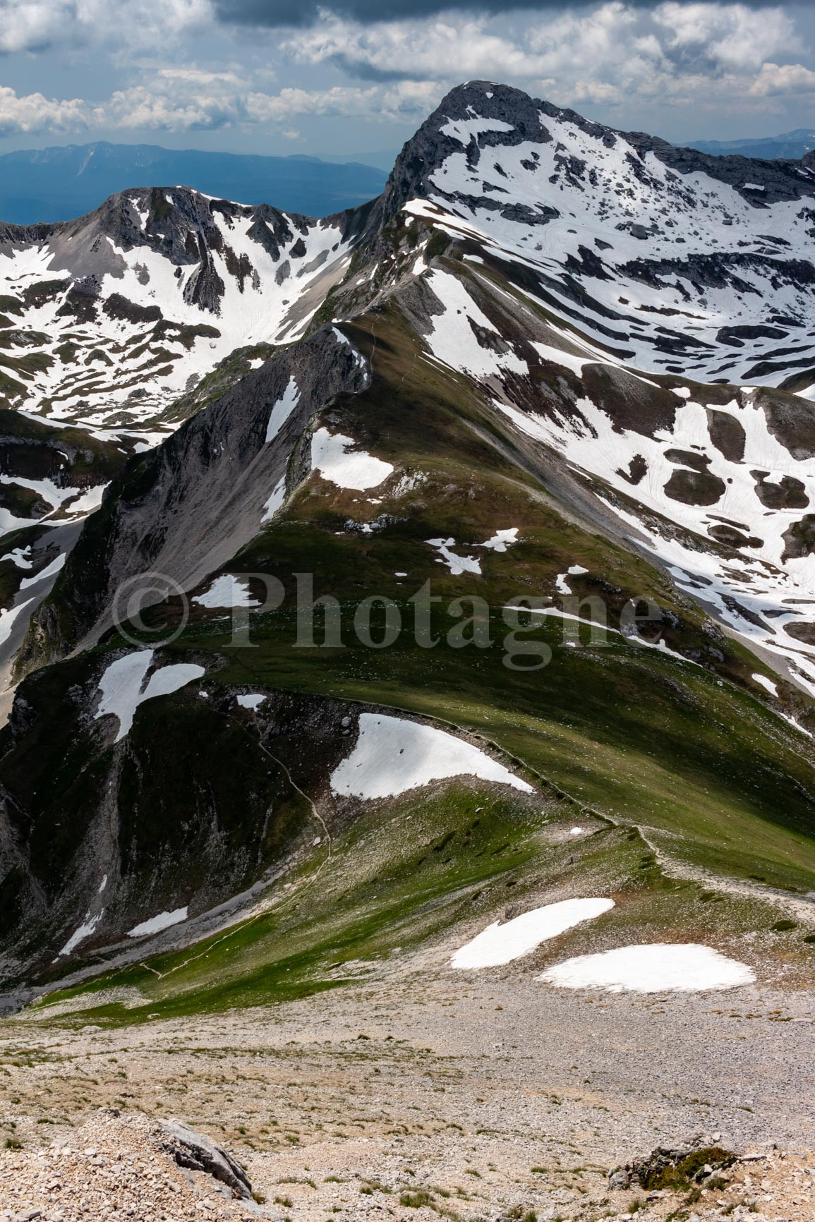
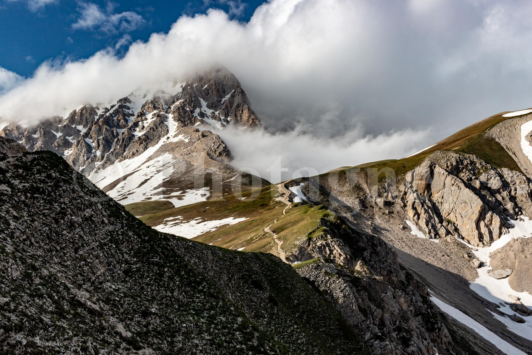
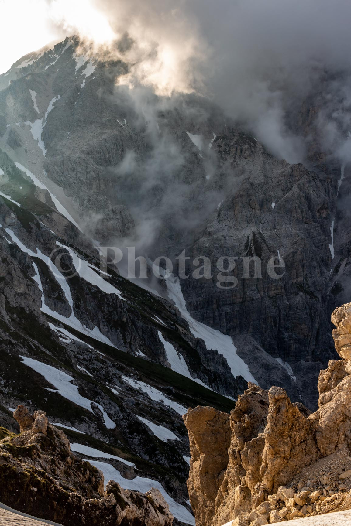
From the summit, the view of Gran Sasso itself is breathtaking. Unfortunately, it's attracting clouds, so we don't see it as well as we did in the morning. We descend the scree slope and enjoy a well-deserved picnic at the pass.
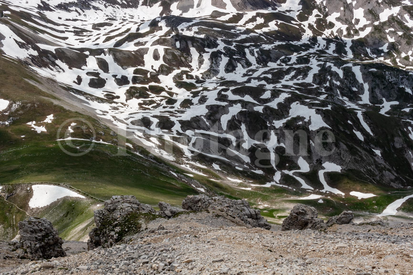
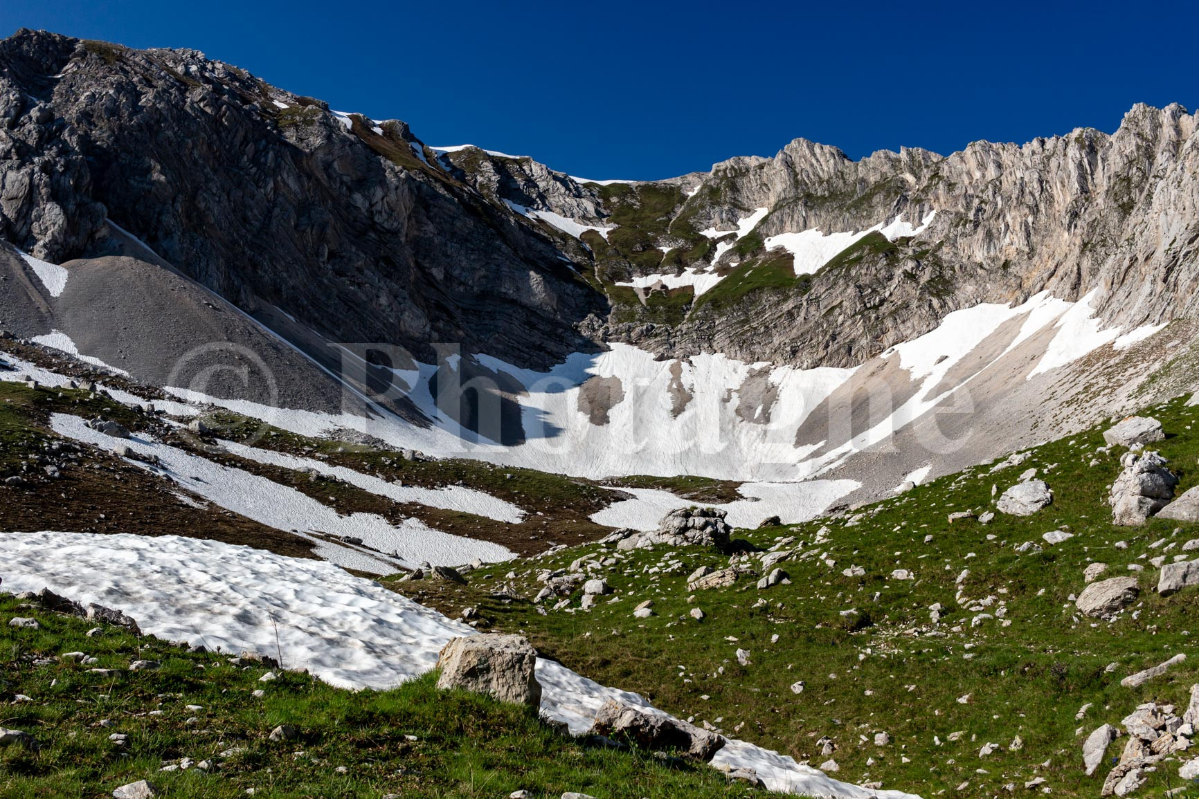
We pass another valley, this time at the foot of the Gran Sasso. The impression of solitude and high mountains is still as intense; there is almost no one around. We have to cross a large snowfield to reach the Portella Pass, fortunately not very steep.
We then follow a superb panoramic path to arrive at the Duca degli Abruzzi refugeUnfortunately, the refuge is closed, and we have no more water. We therefore have to go back down to the road to find a fountain.
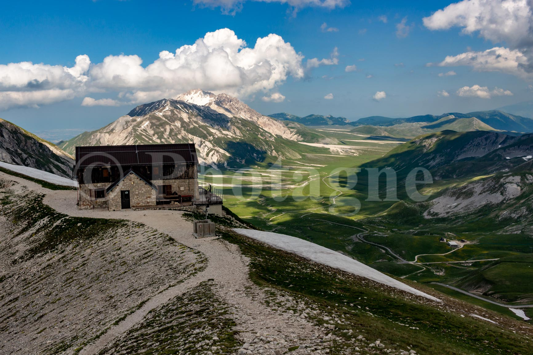
After which we set off again in the late afternoon, our legs a little tired from all the elevation gain. We head towards Monte Aquila, passing right at the foot of Gran Sasso. The late afternoon light on the deserted mountain is breathtaking...
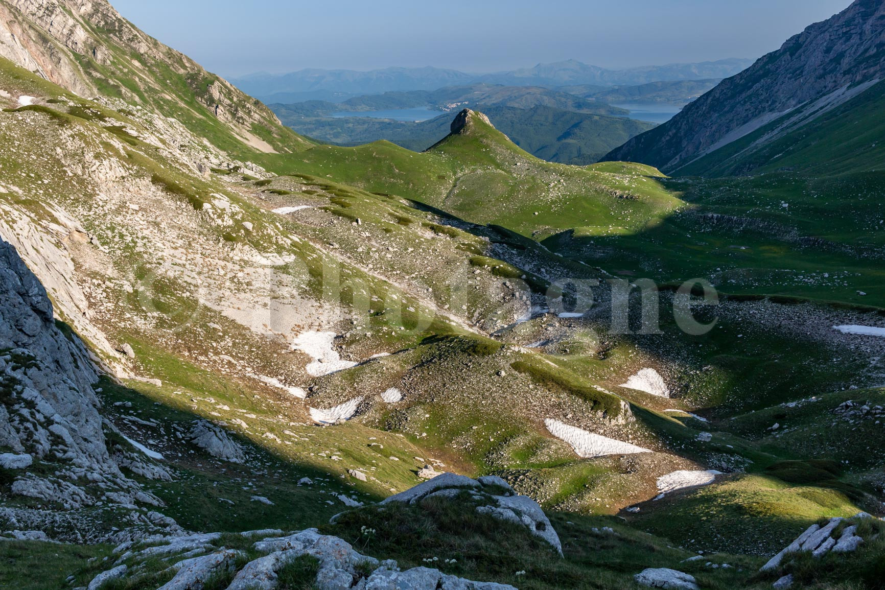
From Monte Aquila, we follow the ridge. A little snow at first makes us fear difficulties because the ridge is narrow, but eventually the path descends quickly and the snow disappears. Another vertical wall of the Gran Sasso appears before us in all its splendor as we progress.
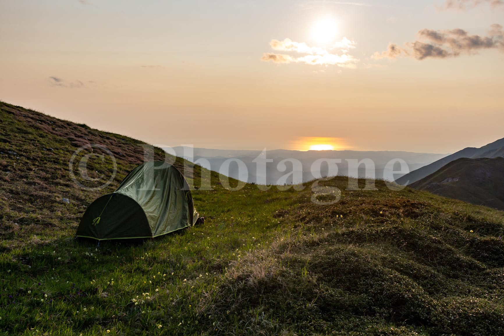
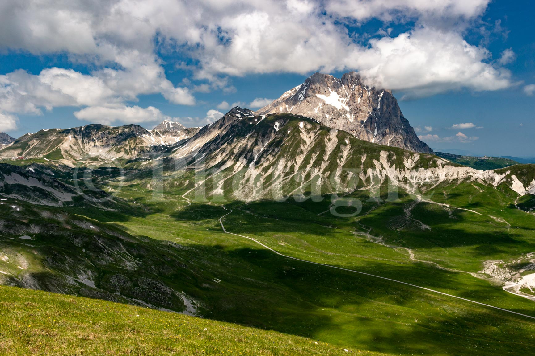
Finally, exhausted, we arrive at a less steep spot where a small grassy plateau awaits us, frequented by a rather shy chamois. It's an ideal spot for our tent, with a majestic view of the entire Campo Imperatore.
Day 3: Campo Imperatore
+ 650 m / – 1550 m 18km
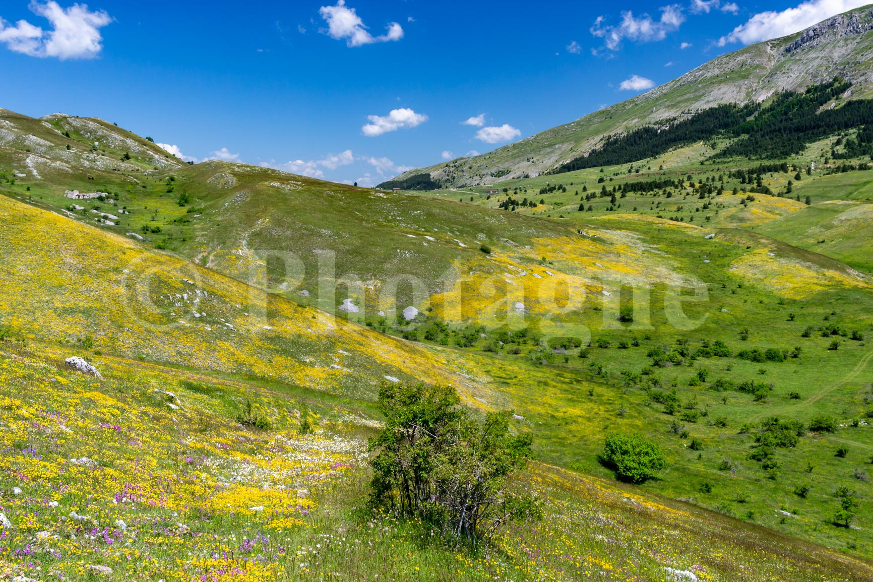
We set off under glorious sunshine to cross the famous Campo Imperatore. The path zigzags across the flower-filled plain, with the mineral peak of Gran Sasso in the background. This flat stage is a chance to rest our legs after the previous day's climb.

But then we quickly gain height again along the hills overlooking Campo Imperatore. It's once again very panoramic and without difficulty.
We finally come down from our heights reluctantly, leaving these sublime landscapes behind us. The path descends along a small stream, the heat increasing as we descend. We finally arrive at the road and then at Fonte Cerreto, where a bus to return directly to L'Aquila. What wonderful memories in my head!
If you liked the landscape photographs on this page, please take a look at the section Pictures. For example, you can order a mountain poster of my photos, which is a good way to support me ;).
0 Comments